


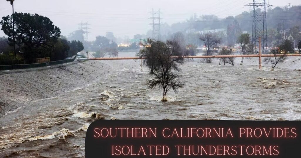
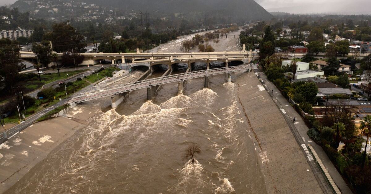
The first drops of rain fell on Ventura County late Tuesday night, followed by Los Angeles early Wednesday morning. Thunderstorms were spotty across the Southland late Wednesday night and early Thursday morning.
Wednesday morning saw light to moderate rain across the Southland, with another round of precipitation approaching in the afternoon. Thicker precipitation fell overnight into Thursday morning, bringing some isolated thunderstorms and snow to the higher elevations.
Due to a mudslide on the hill on Thursday morning, Wrightwood Road was blocked as a safety precaution at Laurie Place in Studio City. Storm damage in the Los Padres National Forest forced the closure of State Highway 33 from Matilija Hot Springs Road to Lockwood Valley Road.

Thursday saw crews at the scene clearing the road of boulders. Many people are worried about the number of landslides and sinkholes that have occurred in recent weeks due to the saturated soil, as the region is still trying to recover from a series of heavy storms that have hit since late 2022.
The most recent storm has been labeled a bombogenesis, also known as an explosive cyclogenesis. This is the 13th storm this season to draw energy from the atmospheric river, and the third “bomb cyclone” to make headlines.
If you’re interested in reading more about this topic from the California Examiner, check out these resources:
- Scorching Heat And Thunderstorms Enter Northern California Forecast
- Wildfires in California Could be Sparked by Dry Thunderstorms
- California is Bracing for the Arrival of Another “Significant” Atmospheric River
As it crossed the Pacific Ocean into Northern California, the storm strengthened, although it is likely to weaken before it reaches the Southland. There is a chance of thunderstorms when the cold air that has been lingering over the area interacts with the storm as it moves eastward and becomes more unstable.
Any thunderstorm has the potential to become a supercell, which would bring even stronger winds, hail, and lightning. Waterspouts and tornadoes, like the one that devastated Southern California not too long ago, are possible due to wind crossover at higher altitudes.
Correspondingly, the tornado that ripped through Montebello left 11 structures with red tags. By 4 a.m., the NWS has already issued a winter storm warning for the San Gabriel Mountains. Starting at 2 p.m. on Wednesday. Communities above 5,000 feet in elevation should anticipate 6-12 inches, and winds of up to 45 mph.
The I-5 Freeway corridor in northern Los Angeles is also under a winter weather advisory. County, where up to an inch of snow could impede Grapevine traffic. As the storm passes late Thursday night, dry but cool weather will return on Friday.
“To bolster the emergency response and recovery in the counties of Calaveras, Kern, Los Angeles, Mariposa, Monterey, San Benito, Santa Cruz, Tulare, and Tuolumne.” California Governor Gavin Newsom submitted a request for a Presidential Major Disaster Declaration on Tuesday afternoon.
After Newsom proclaimed a state of emergency for 13 counties in early March, President Joseph Biden granted the governor’s request for an emergency proclamation.
The California Examiner is your source for immediate updates on events in your area, and they may include previously unknown information.